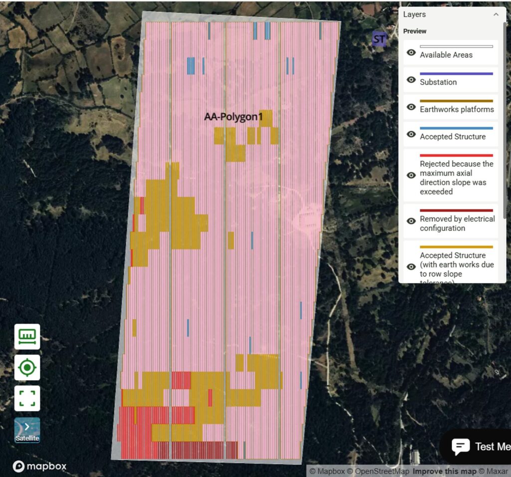
RatedPower permite ahora el uso de trackers con seguimiento del terreno directamente en el diseño de los proyectos, realiza cálculos avanzados de movimientos de tierras y amplia las capacidades de diseño y modelización BESS.
Why it matters: Automated earthworks and BESS integration are now table stakes for project developers; if your team is still doing this in CAD, you're hemorrhaging margin.
Software solves math, not bureaucracy
RatedPower (now part of Enverus) is tightening the screws on the 'design-to-permit' pipeline. Adding terrain-following trackers and automated earthworks calculations into the UI is a godsend for developers who are tired of manual Civil 3D loops just to figure out if a site is viable. If you've ever had a project die in the feasibility stage because the grading costs were underestimated by 15%, you know exactly why this matters.
The BESS bottleneck
The real signal here isn't the tracker optimization—it’s the BESS modeling. As we move from simple 'energy-only' plays to complex grid-balancing services in markets like Italy and the UK, being able to iterate on battery capacity and DC-coupling ratios within the same platform where you design the PV plant is a massive time-saver.
However, let’s be real: no amount of software wizardry fixes the glacial pace of connection queues in Spain or the 'NIMBY' resistance in rural France. You can model the perfect site, but if your DNO (Distribution Network Operator) takes 18 months to issue a connection offer, your software ROI is effectively zero. Use RatedPower to win the internal approval battle, but don't mistake a shiny model for a 'Ready-to-Build' shovel in the ground.